
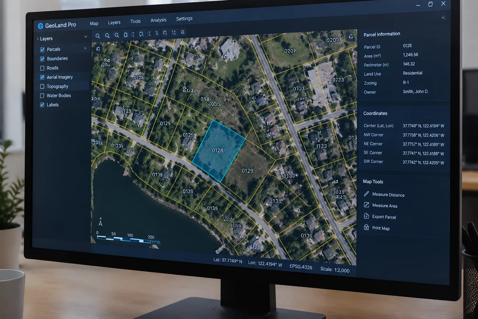
The Inherent Divide: Legal Lots Versus Delivery Endpoints
Modern shipping engines and CRM databases constantly conflate two fundamentally different geographical concepts: the county cadastral parcel and the postal delivery point. When a civil developer carves a sixty-acre tract into ninety residential home sites, the municipal planning office issues provisional street names, numbers, and Assessor Parcel Numbers (APN). These identifiers appear legally binding on deed registries, engineering blueprints, and builder utility applications. Yet, to major parcel carriers and postal routing networks, none of those addresses exist in reality until an approved physical mail receptacle is positioned, inspected, and cataloged into official carrier route rosters.
This timing gap generates immense friction across logistics pipelines. When customers purchase construction supplies, fixtures, or retail products for newly constructed properties, checkout validation engines run the entered text against national address validation tables. Because the municipal planning office has not finalized the carrier route sequence, the API rejects the record or suggests ambiguous neighboring locations. Dispatched orders get misrouted or flagged with carrier correction fees, leaving fulfillment specialists scrambling to diagnose whether the failure stems from a customer typo or an unlinked land record.
Cadastral Attributes in Direct Contrast with Carrier Tables
To handle in-flight land records accurately, operations teams must trace how property registry attributes diverge from carrier databases. The table below outlines how common parcel characteristics behave when evaluated by standardized address validation rules.
| Record Attribute | Observed State | Ledger Rule |
|---|---|---|
| Assessor Parcel ID (APN) | Valid in county GIS tax tables but nonexistent in USPS Delivery Point Validation (DPV). | Isolate municipal parcel metadata into reference fields; do not format into line 1. |
| Provisional House Number | Assigned by local emergency dispatch GIS, but missing from ZIP+4 carrier tables. | Designate record as Provisional-Siting; mandate manual dispatch routing check. |
| Parcel Centroid Coordinates | Geocodes land polygon midpoint, frequently 500+ feet away from real roadside access. | Prohibit centroid math from replacing verified carrier curb drop coordinates. |
| Split Parent Parcel | Subdivided lots continue returning the parent farm house address during query. | Require customer boundary survey confirmation before updating order destinations. |
Subdivision Lifecycle Latency and Boundary Ambiguity
The gap between local deed recording and carrier recognition is characterized by significant administrative lag. When a planning authority records a subdivision, municipal GIS technicians enter polygon boundaries into internal county mapping engines. They assign prospective house numbers based on street front measurement formulas. From that instant, the property owner considers the address official and begins submitting orders under that identity.
An address validated by county cadastral zoning confirms legal land title, not carrier deliverability. Confusing parcel boundaries with postal drop points is the root cause of systemic new-construction transit failures.
USPS local postmasters review new subdivisions only when physical roads are paved, safety gates are evaluated, and cluster box units (CBUs) are installed. Carrier route rosters are updated on scheduled monthly cycles, which third-party validation engines acquire through quarterly data updates. An enterprise shipping system that automatically rejects any record failing DPV validation blocks genuine commerce on new builds, while one that forces delivery to ambiguous parent coordinates incurs lost cargo and penalty fees.
Ledger Protocol for Provisional and Unverified Properties
To balance smooth fulfillment with strict data control, operations architects must separate provisional land markers from verified operational addresses using disciplined state transitions:
- Establish a distinct Provisional state in your address data model to store permit IDs, parcel tags, and temporary access codes without contaminating validated customer master records.
- Deploy polygon boundary cross-checks in proptech and utility tools, ensuring geocoded points fall strictly within legal parcel extents rather than snapping to default street centerlines.
- Schedule automated re-validation sweeps against updated carrier directories every thirty days for all records flagged as Provisional until full delivery confirmation is secured.